
 Asset Publisher
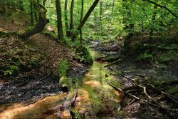
NATURA 2000 AREAS


 Obszary Natura 2000, fot. K Moroz
 Obszary Natura 2000, fot. K Moroz
 Obszary Natura 2000, fot. Michał Poklewski-Koziełł
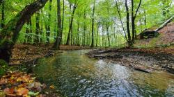
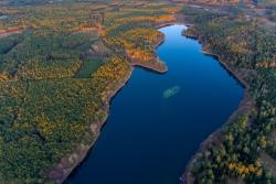
European Ecological Network Natura 2000 is a kind of system of areas connected one with each other by ecological corridors. These areas form together a coherent ecological network, of which basic task is prevention of biodiversity. It happens through protection of the most valuable and the most rare nature elements.
Among "Natura 2000" areas of the forest district are:
- Natura 2000 area "The Valley of Ilanka River" (code B PLH080009), total area: 2 012 ha, includes the most attractive fragment of the Ilanka Valley with low peatlands on calcareous surface which are best preserved in the Lubuskie province (their total area is about 90 ha). Apart from peatlands which determine the nature of the sanctuary there are riparian forests and on the most steep slopes of river gorges - beech, alder etc. Basically, 10 habitats that are environmentally valuable according to the appendix of the First Habitat Directive can be distinguished, 7 animal species from the appendix of the Second Habitat Directive, 11 nationally endangered species, 18 protected plants.
- Natura 2000 area The Valley of Pliszka River" (code K PLH080011), total area: 3 216 ha, covers a small river valley located on vast sandur fields. The River Pliszka has preserved its natural characteristic and is surrounded by a vast forest complex (mainly pine woods). Along the river various peatlands occur as well as sloughs, patches of riverside forest groups. In general there are 9 environmentally valuable habitats from the appendix of the First Habitat Directive. The flora of the region is enriched by 9 nationally endangered species, 22 protected plants and 7 nationally rare species. On the area there are also 5 species of the appendix of the Second Habitat Directive.
- Natura 2000 area "Old Oak Wood in Koryta".
In addition, "Trough of Torzym Lakes" off shadowlist is awaiting its confirmation.
Asset Publisher


Asset Publisher
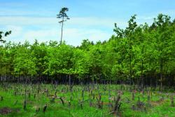
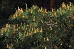
FORESTS OF THE FOREST DISTRICT
FORESTS OF THE FOREST DISTRICT
 Lasy nadleśnictwa, fot. K Moroz
 Lasy nadleśnictwa, fot. K Moroz
In accordance with nature and forest regionalization of Torzym Forest District is located in located in the 3rd Land of Greater Poland and Pomerania on the border of Lubuskie Lake District in Lubuskie mesoregion. The average annual rainfall is approximately 600 mm and temperature is 8.3 degrees. Vegetative period is about 225-240 days.
The area of the forest district is lowland and located nearly complete in mesoregion of the Torzym Plain. Outermost forest areas (south-eastern part) of the forest district belong to the Łagów Lake District mesoregion. Middle and northern part of the forest constitutes part of the Lubuskie forest located on vast slightly undulated outwash plains crossed by river valleys (Pliszka and Ianka rivers), numerous peat bogs and mushy areas. In the region of Torzym and Boczów lakes there are hills up to 129 m above the sea level. Additionally, in this forest district features the edge of bottom and morainic deposits. Northern part of the forest district is of completely different nature as the landscape is typical of early post-glacial areas. It includes diverse outwash landforms with outcrops of glacial deposits, numerous postglacial channels (the River Ilanka). In this part of the forest district the highest height of land reach 140 m above the sea level and difference in relative heights reach 40-50 metres.
Surface area of the forest district is 21 745.08 ha while its territorial range is 33 546.55 ha (includes 20 975.96 ha of forest lands). Aforested areas occupy 20 189.33 ha, non-forested - 171.96 ha and forest management lands - 614.58 ha.
Torzym Forest Districts is characterised by relatively low fragmentation. Dense, large areas of forest complexes occur in Gątków Wielki precinct, in the southern part of Torzym precinct and south-western part of Wystok precinct. The largest area of forest complex (10 000 ha) is within the following sub-districts: Torzym, Korytno, Drzewce, Dębrznica Środkowo and Gądków.
Woodiness of Torzym Forest District is 62.1%.